 |
| le Lac. |
 |
| Vitrolles |
Walk back down to the entry of the old town where the GR97 passes by. You see the yellow signpost for walkers and you take the direction for Les Pins. Stay on the GR path for about 750 meters (along the road) till you see a new yellow sighpost. Take left here and walk along this marked path first going east, then turning north till you see another signpost at Garbonnel. Here you turn right along the GR97 going east.
 |
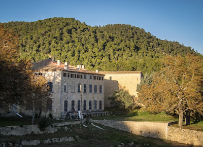
| Luzerne Ruins |
You follow the GR signs
for the rest of the morning. When you have walked about 1 hour from the car, you have the “famous” Lac de
Vitrolles” on your right (200 meters). Take a look, it’s a charming place.
You keep following the GR
along the forest road for another 1 hour till you see the yellow signpost in a
sharp turn. Here you see the GR takes left off the road and onto a good forest
path. It takes about another 30 minutes before you meet the road again and here
you take sharp left and then almost immediately left again on an old track road
leading to the Luzerne Ruins (see map), where it would be nice to have lunch.
After passing the ruins on
the track road, follow it further (parallel to the main Crete road) until it
joins the main Crete road. This road is yellow marked (in places) and you
should follow the main road for about 1hour 45 minutes till you see the yellow
signpost on the 681 meter point. Here you turn left and follow for Vitrolles.
There are 2 main short cuts along 1 hour 45 minutes on the Crete (see map and
GPX-file) that could save you 15 minutes, but you will miss the views and the
sun shine on the main road.
Walking down from the 681
meter point, you will cross the main road after 15 minutes and continue down to
the yellow signpost at the 539 meter point. Here you turn left and join the GR
trail that will take you back to Vitrolles in another 20 minutes or about 45
minutes from the 681 meter point.
Basic
information:
Duration: 6h ( including 1h for lunch)
Distance: 17 km.
Ascent: 350 m (accumulated)
Difficulty: Easy
Start/finish: Vitrolles-en-Provence
Maps: IGN TOP25 No. 3243 OT (Pertuis) and No. 3342 OT (Manosque).
GPX: Vitrolles1 (Link to free download from list)
If you have problems with this VisoRando link, download the GPX-file (Vitrolles1) from above and import it to VisoRando or other application.
TET:
09.02.2020 Anne. Lunch at ruins at 12.05 (very good). 5h+1h lunch. Great for winter and Mistral.
VisoRando Lien.
Pour le fichier GPX, vous pouvez télécharger à partir d'ici (voir ci-dessus) ou mettre à jour via ce lien VisoRando où vous pourrez également voir l'itinéraire sur une bonne carte:
For the GPX-file, you could download from here (see just above) or go to this VisoRando link where you also will see the route on a good map:
If you have problems with this VisoRando link, download the GPX-file (Vitrolles1) from above and import it to VisoRando or other application.
TET:
09.02.2020 Anne. Lunch at ruins at 12.05 (very good). 5h+1h lunch. Great for winter and Mistral.


No comments:
Post a Comment