
 |
| Chapelle Saint Pilon |
This walk explores the north
eastern face of the long Sainte-Baume Massive (several Caves along the route –
bring a lamp) in addition to taking in about 40 minutes along perhaps nicest
part of the ridge. The northern side is quite cold (little sun) and wet during
the winter season, so I suggest you do this walk outside the winter season. I
also strongly suggest you use a GPS aid (preferable with the GPX-file showing
the path) in order to find the smaller paths.
 |
| La Grotte aux Oeufs. |
Dive on to Plan-d’Aups or
Nans-les-Pins (whichever is nearest you) and drive on to La Sainte-Baume (le
Hotellerie) where parking is easy. The walk starts 200 meters west of the main
Café/Restaurant on an unmarked dirt road going straight south. When you reach
the 678 meter point, turn right onto the track road going west here. You walk
through forest, but after some 500 meters (at the fire hydrant), you turn left
and follow up to the water reservoir marked PA5-2. You walk on behind this and
around (turning right) and follow the path (passed a small cave) upwards till
you reach a main track road (300 m from the reservoir and about 30 minutes from
the car).
 |
| Grotte Sainte-Marie-Madeleine. |
At this main track road, turn left,
but after only some 150 meters you take a small path off to the right (uphill –
big tree marked with red thick stripe and path marked green). Following the
green marks, you should be in front of Grotte aux Oeufs in about 20 minutes
from the main track road. We did not enter the cave as it is a very steep and
slippery entry.
Continue the path further east (now
marked dark blue) for about 500m (about 25 minutes) with great views along the
way. Here you see a path taking off to the right (slightly back again). Walk up
and have a look. This is the ruins of the house built by
Dalmace MONER in front of a cave.
He was an Dominican eremite living in the 14th century. A nice
“terrace” in front with a bench and great views.
 |
| Le Crete with Montagne de Garlaban behind. |
Continue the path going east (now
marked brown and red) and you quickly come to the big concrete structure
underneath the famous Grotte Sainte-Marie-Madeleine. Walk up on this structure
and walk further along till you join the main path (steps) coming up from
Hotellerie de la Sainte-Baume. A visit here will take you some 20 minutes in total,
involving climbing up some 70 meters to the entry to the massive cave.
 |
| Grotte Sainte-Marie-Madeleine. |
Back down from the cave you walk
downhill for about 200 meters to a large junction. Take the first right here,
which is the GR trail to the top of the mountain. You will be at Col du
Saint-Pilon (the pass) in about 20 minutes. Here there are lots of places for
pick-nicks in the sun (no shade!).
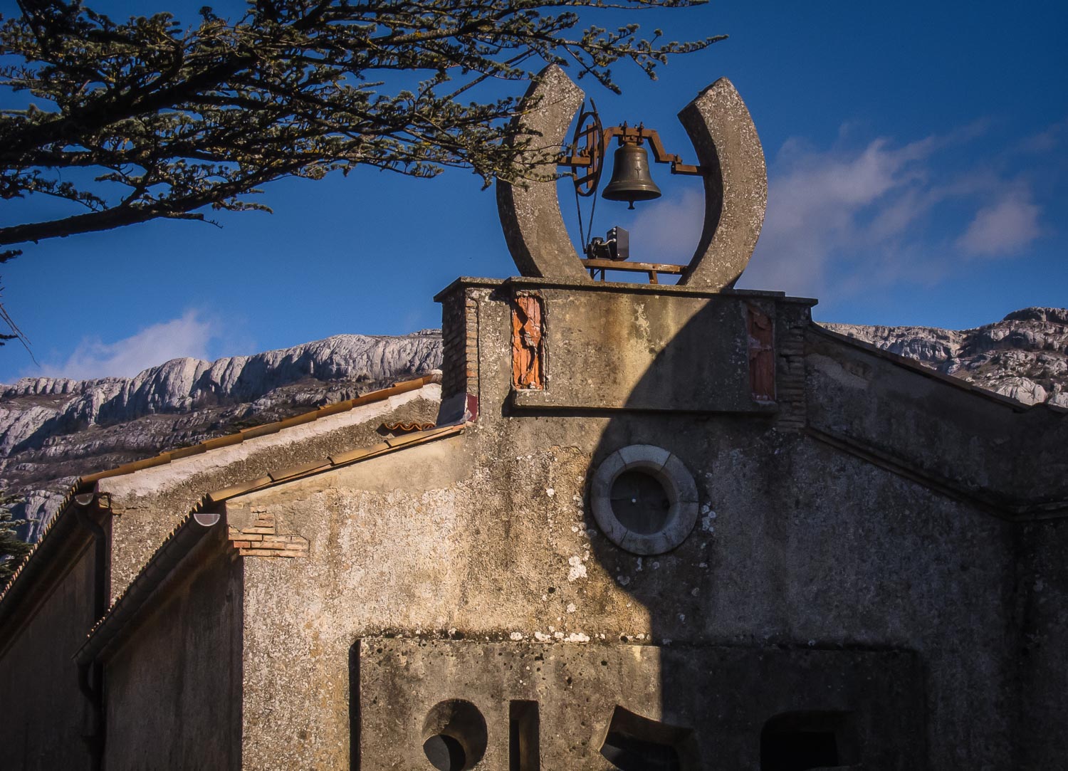
We shall now follow the main
mountain ridge westwards on the GR98 or if you prefer right up along the ridge
(parallel). You will have Chapelle Saint-Pilon on your right after some 10-15
minutes (take a good look). Leaving the Chapelle, you should be especially observant
to find your exit path from the ridge!
After some 20 minutes you should see a red and brown circle with an arrow and
the text “Pas de la Cabre (Grotte)” painted on a large low stone on your right.
You leave the mountain ridge here on this small path marked brown and red.
 |
| Le Crete. |
This is a very charming small path
(not marked on some maps, e.g. IGN maps), but it is not difficult and acts as a
balcony route slowly down from the mountain going eastwards (back again). It
will eventually join your green and red path from this morning and you will
again end up on the big concrete structure straight underneath Grotte
Sainte-Marie-Madeleine after some 30 minutes from the mountain ridge.
 |
| The view from the car park. |
Walk again the some 200 meters downhill
to the main junction. This time you walk straight on downhill (yellow markings)
and you will be down near a large parking area
at the 677 meter point. To avoid the main road, follow the signpost to
the left marked “Hotellerie” all the way back to the car.
Basic
information:
Duration: 5h (incl. 1h lunch)
Distance: 9 km.
Ascent: 500m
Difficulty: Moderate plus
Start/finish: La Sainte-Baume (le Hotellerie)
Map: IGN 3245 ET (Aubagne – La Ciotat)
VisoRando Lien.
Pour le fichier GPX,
vous pouvez télécharger à partir d'ici (voir ci-dessus) ou mettre à jour via ce
lien VisoRando où vous pourrez également voir l'itinéraire sur une bonne carte:
For the GPX-file, you
could download from here (see just above) or go to this VisoRando link where
you also will see the route on a good
map.
If
you have problems with this VisoRando link, download the GPX-file from above
and import it to VisoRando or other application.
TET:
Bjorn planned for May/June.
 |
| Chapelle Saint Pilon with Grotte Sainte-Marie-Madeleine just below. |
Maravilloso sitio!!!! Lo místico de la naturaleza y del amor de la Maestra María Magdalena llena el alma
ReplyDelete