Showing posts with label Cassis. Show all posts

Saturday, March 22, 2014

Cassis (Stele): Les Calanques, Col Gardiol, Falaise du Devenson, Calanques des l'Oule et l'Eissadon.


Falaises du Devenson
 This is yet another fantastic walk in the Calanques designed for winter time; i.e. no swimming because you don’t easily get down to the sea (unless you count on an extra 3 km. return, going down to Calanques d’en Vau). You start at the big parking at Col de la Gardiole and head straight for the sea at Calanques de l’Oule and Eissadon. You continue along the sea on Falaises du Devenson to Col du Devenson and here you join the GR51 for the route back to the car.

The road up to Col de la Gardiole has been closed and there is a parking down at the 234 meter point. But I have chosen a new parking closer to Cassis at the 236 meter point called Stele. This is the new depart/arrival point for this walk, also reflected on the GPX-file and on the VisoRando link.

To find Col de la Gardiole from Cassis, you take the main road towards Marseille, and where there is a road sign to the right for “Camp de Carpiagne” at the 234 meter point, you turn left just afterwards at the 235 meter point. Follow the small and sometimes bad road all the way up to Col de la Gardiole (260 meter point), where there is a big parking.

Follow the red 7 trail (also marked green) down to a large intersection just after passing the Maison Forestiere (15 min). Continue the red trail to the right, but after only some 5 minutes (large cairn on your left), I propose you take this unmarked track to the left. (Alternatively, and for those who do not fancy a steep slope with lots of loose stones for 5 minutes, just continue the main red 7 trail down to where it meets up with the GR51 at the 70 meters point.)

The unmarked trail is not really a short cut, just a way of keeping the nice views of the sea longer, and to avoid walking on the hard “road” too long. You need to be a good map-reader, however, so just follow the trail according to the map. The trail will after a while become a path and after 15 minutes you see down to a trail 50 meters or so below you in the valley. Follow the small stony path that circles down to the narrow valley floor (takes 3-6 minutes, depending on skills). At the bottom, just follow the trail here to the right back to the red 7 trail just below the 70 meters point (about 10 minutes).

When you meet up with the red 7 trail again, turn right, but walk only 50 meters because here you want the GR51 (and green) to the left for Col de L’Oule, where you arrive after climbing about 15 minutes, or a good hour from the car.

Calanque de l'Oule
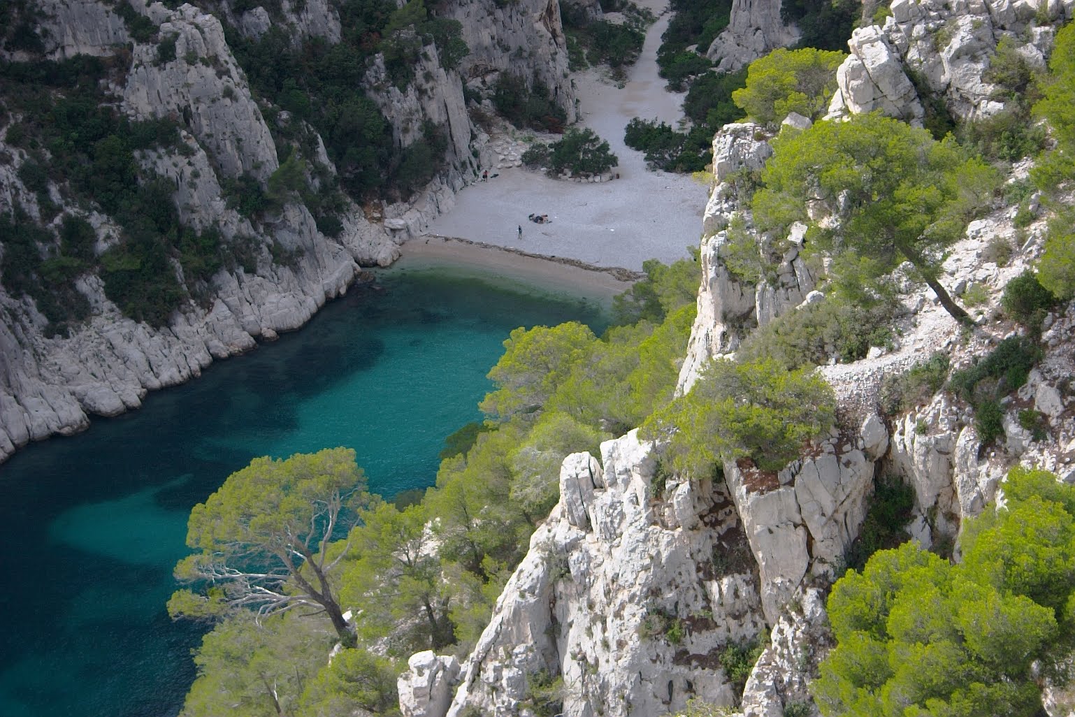
If you are dying for lunch already, I suggest you walk about 10 minutes along the blue 2 trail towards the Belvedere d’en Vau. You will find the best places for lunch to the right along the cliff top, facing west, or all the way out at the Belvedere (15 min), where you have the most spectacular view of the whole of Calanque d’en Vau.

For those who can wait another 35 minutes or so for lunch, you take the GR51 for another 5 minutes down to where the green 8 trail takes off to the left near Puits de l’Oule (a well, easily seen). Now walk along this green path down to Grotto de l’Oule (You see a small cairn on the left about 20 minutes after the well, marking the path to the Grotto.) You get to the lowest point of the path just after having passed the cairn by the Grotto, and now climb up for about 10 minutes to what we can call Col de l’Oule. Here is a few nice places for lunch only a few meters from the sea, but high up. You see straight down into Calanque de l’Eissadon (you could get down to the water here, but it’s tricky), but if you walk up to the left and follow the ridge out, you see down into Calanque de l’Oule on the other side.

Calanque de l'Eissadon
You could lunch here, and it is advisable if it’s a windy day. However, because you have a very steep climb just in front of you, it could be advisable to take this 20 minutes climb before lunch. You are now up on the plateau of Falaises du Stevenson about 2,5 hours after leaving the car.

Walking along the Falaise du Stevenson, you have wonderful views of the sea and the coast in all directions. You walk for about 30 minutes until Col du Stevenson. Here you can see the GR51 coming up from the valley, joining your green 8 path. This is the point to think about returning to the car. Take the GR51 to the right down into the valley and up the next valley etc. back to Col de l’Oule (about 40 minutes). From here, you have another 50 minutes up to the car.   

The quickest way back from Col de l’Oule is following the brown path 5 all the way to Maison Forestiere and then up to the car on the road marked red and green.


Basic information:

Duration:       6h (incl. 1 hour for lunch)
Distance:      15 km.
Ascent:          630 m
Difficulty:        Moderate, but demanding in places and not for people suffering vertigo.
Start/finish:     Parking de Stele at the 236m point on the D559 from Cassis to Marseille.
Map:               IGN Les Calanques de Marseille a Cassis (1cm=150 m)


VisoRando Lien.
Pour le fichier GPX, vous pouvez télécharger à partir d'ici (voir ci-dessus) ou mettre à jour via ce lien VisoRando où vous pourrez également voir l'itinéraire sur une bonne carte:


For the GPX-file, you could download from here (see just above) or go to this VisoRando link where you also will see the route on a good map.


If you have problems with this VisoRando link, download the GPX-file from above and import it to VisoRando or other application.


Sunday, September 19, 2010

Cassis: Les Calanques, Port Miou, Porte Pin et Calanque d'en Vau.


The Calanques between Marseille and Cassis is my favourite French Mediterranean coast line. It’s 30 km. of no permanent dwellings, fantastic scenery all the way and good for swimming May till October. It’s also well known for climbing for those that fancy that.

The area is normally closed to the public from 1st July till 15th September (except for morning walks till 11 am) because of the risk of forest fires. But call 0811 201313 for exact information.


Approaching Cassis by car, simply follow the well signposted route to “Les Calanques” with parking on the Presque Iles (Port Miou). On the way there, just west of the town centre, you pass a small beach with a car park on the opposite side of the road (La Plage du Bestouan). I normally take my coffee here before walks (Henry Blanc coffee from Marseille at the café along the road there!). Drive on, following signposts for Calanques and Presque Iles, and another 3 minutes you park you car along Avenue Noire Dame, or at the end of this Avenue, where there is a car park. The best place to park is around the point where this Avenue is at its highest, because here the trail out to the calanques starts.

The trail (marked 8a on the local map) starts off by crossing down to Avenue des Calanques and hen take the main trail (trail 8) out along Calanques de Port Miou. You gain a little hight and I suggest you take right and follow trail 8b all the way up to the Youth Hostel (Auberge de jeunesse) at the 192 meter     point. Here you head straight south, but only for about 150 meters, where you turn right along trail 7a, marked for Maison Forestiere. You meet the main trail 7 at the 209 meter point near the Maison Forestiere, and simply follow this all the way down to Calanque d’en Vau for lunch and a swim.


If it’s during the winter, or you simply fancy the lunch high up with a really good view of the sea and nearby islands, take trail 8 (GR51 & 98) to the right up to Col de l’Oule and follow trail 2 out to the view point (Belvedere d’en Vau).
From the beach at En Vau, return back again the same route for about 10 minutes before you turn right up trail 8 (GR51 & 98). This is a short but breathtaking climb that will take you anything from 10 to 20 minutes, depending on fitness. Once you are up on this plateau, don’t continue trail 8 straight for Calanque de Port Pin unless you are in a hurry. Use a good hour on the magic rout along the two calanques by following blue markers all the way (trail 4). The views along this route are just too good to be believed, especially late in the day when the sun is right and you have the back drop of Cassis town and the large cliffs on the eastern side (highest cliffs along the coast of France – Cap Canaille – 400 meters strait down).
Finally at the beach Calanque de Port Pin, take another swim, or follow trail 8 (GR 51 & 98) up the hill towards Cassis (30 minutes to the car). On top of this first hill, don’t follow the main trail to the left, but go slightly to the right and you see a large trail going down to the left much closer to the sea. Simply follow this trail along the water front and you eventually join up with the main trail at the large flat area (old quarries). You are now back where you started. Return to the car the same way as you came.


Shorter hike for high summer (4h)
When the weather is hot, start early in the morning. On this particular hike we started at 8.30 and stayed along the coast line almost all the time. First head for Calanque de Port Pin, but don't go down at first. Take the "tour" out to Pointe de la Cacau, following close to the sea at each side. You will be back and down on the beach at Calanque de Port Pin at around 9.30. 

Now follow the blue trail along the sea going south-west (you can start on the unmarked trail close to the sea, and climb up to the blue trail a bit later on). Walk all the way around on the blue trail. Make sure you get the nice views of Calanque d'en Vau from in front of the Refuge de Piolet (small cottage) and other places along the route. You end up on the central junction where you meet the GR51/98 trail, and you follow this trail down to the beach at Calanque d'en Vau (steep at first) where you will be around 11.45.

We left the beach at 13.00 and took the direct route back to Cassis. It takes about 30 min. back up to the central junction, another 20 min. to the beach at Calanque de Port Pin and perhaps 40 minutes from there back to the car at about 14.30. All the times given here is included plenty of breaks along the way (more than usual because of the heat).


Basic information:

Duration:        6h (including 1h for lunch)
Distance:        14 km.
Ascent:           550 m
Difficulty:      Moderate
Start/finish:    Cassis (Parking le Presque Isles)
Map:              IGN Les Calanques de Marseille a Cassis (1cm=150 m)


VisoRando Lien.
Pour le fichier GPX, vous pouvez télécharger à partir d'ici (voir ci-dessus) ou mettre à jour via ce lien VisoRando où vous pourrez également voir l'itinéraire sur une bonne carte:


For the GPX-file, you could download from here (see just above) or go to this VisoRando link where you also will see the route on a good map.

If you have problems with this VisoRando link, download the GPX-file from above and import it to VisoRando or other application.


TET
18.06.2021, Chloe: High summer shorter walk (6h total). This walk has become more "difficult" with the years, or is it us that is getting older? 12 km, 500 m, moyen ++, passages très escarpés pour descendre dans la calanque d’En Vau.